Fall 2023 Issue
Photo Credit: Sotkcton University
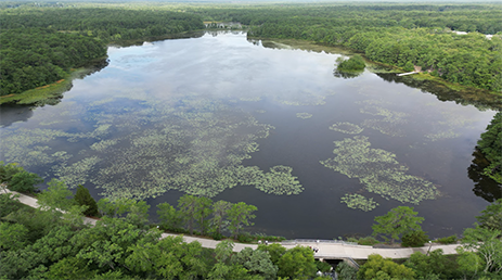
Lake Fred, a prominent feature of Stockton University, has always captured our interest. Questions about its true size and depth have piqued our curiosity, motivating us to embark on an engaging investigation. In collaboration with the Marine Science Club, our mission is straightforward: to accurately measure Lake Fred’s dimensions and uncover the ecological story beneath its surface.
Unraveling Lake Fred’s History
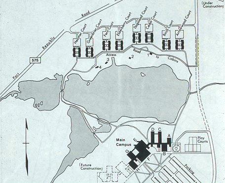
Lake Fred's history dates back to the 19th century when it was created between the
1860s and 1870s for cranberry production. Over the years, it underwent several transformations,
from its use by the Sawmill Corporation to the construction of log cabins along its
shore in 1957. In 1971, Stockton State College acquired the lake, turning it into
a significant university symbol. Dr. Claude Epstein's 1981 study estimated the lake's
area to be approximately 37 acres or 149,734 square meters, but we hypothesize that,
given contemporary environmental factors, the lake's current size may reveal a different
story.
Methods & Techniques
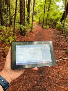
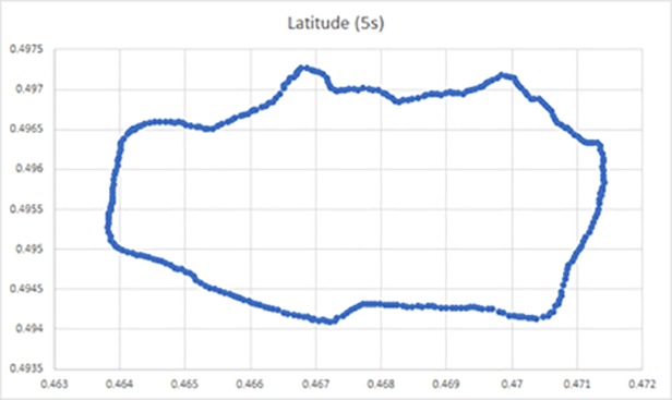
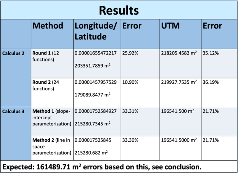
Our quest to uncover Lake Fred's true dimensions blended calculus with technology. We utilized the Vernier LabQuest 3 device for data collection and the DJI Mini 3 Pro drone to capture aerial images of the lake, granting us a beautiful bird's-eye view. Our journey through calculus involved two key methods: Calculus II, which divided data points and employed curve-fitting, and Calculus III, where we utilized Green’s Theorem to parametrize the lake's simple closed curve. These methods, combined with the computational power of Maple software, enabled us to calculate Lake Fred's dimensions with precision.
Our Data:
The slight discrepancies in our calculations can be attributed to the additional area recorded by the GPS device when tracing the trails around the lake. The Calculus II method exhibited an error of approximately 35 percent, while the Calculus III method had an error of around 20 percent when compared to estimates from Google Earth. Nevertheless, our study underscores the practical utility of advanced calculus in real-world applications, even when factoring in such nuances.
Insights and Conclusion
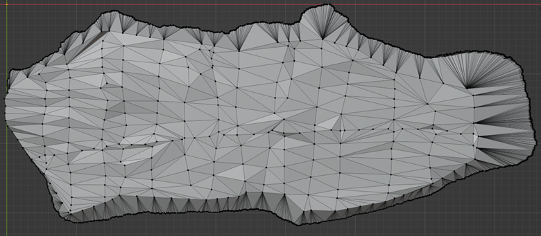
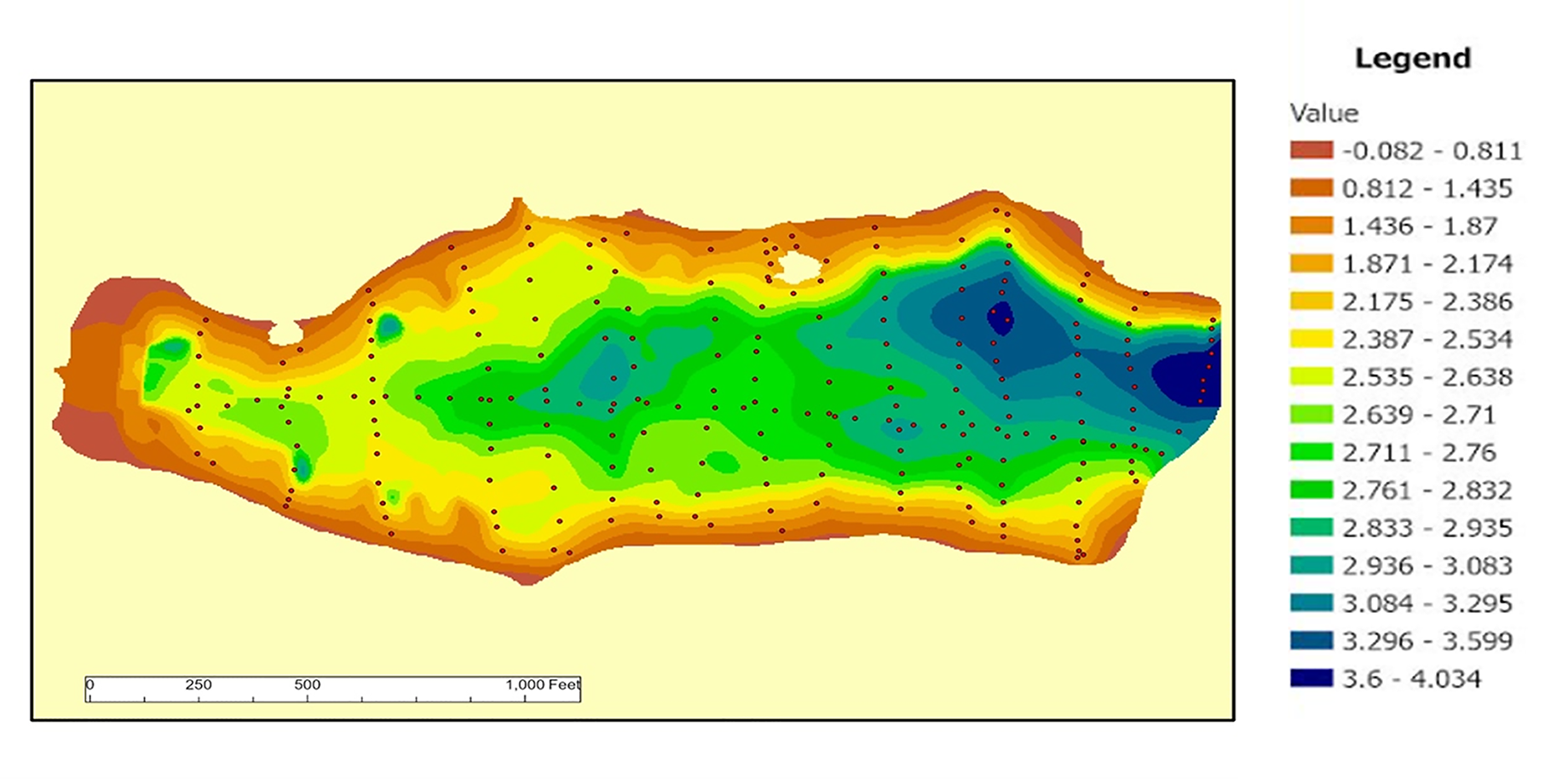
In summary, our study underscores the essential role of calculus in unraveling the complexities of our natural environment. By combining advanced technology with mathematical precision, we've gained a deeper insight into the ecological narrative of Lake Fred. Our ongoing work involves the creation of 3D models of the lake's geometry, utilizing bathymetry data provided by the Marine Science Club. Currently, we are using this data to develop Blender models that accurately depict the lake's depth and dimensions.
Blender Renditions of Lake Fred
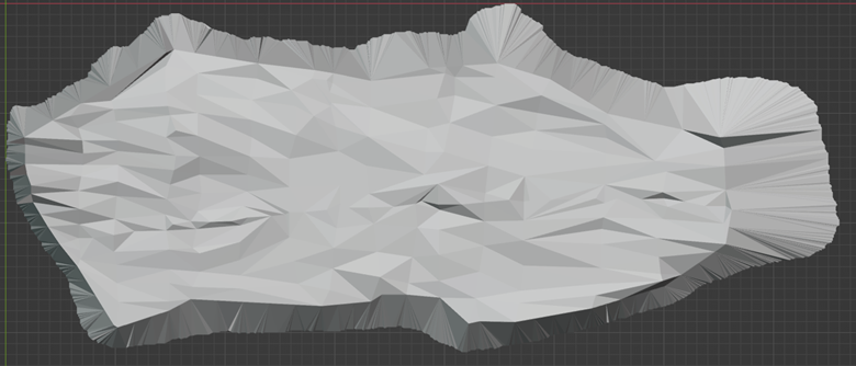
- Blender rendition of Lake Fred